West Branch Susquehanna River at Jersey Shore, Pa.
Overview
- Station Id: 01549760
- County: Lycoming
- Drainage Area: 5,229 sq.mi.
- Station Coordinates: 41.202°, -77.252°
- Period of record: 10/04 to present
Location Description
Station is on bridge 0.57 miles east of Jersey shore on SR 44. West Branch splits around long island on SR 44. Verticals are collected from both branches and composited into one sample.
Data
- Data File Description
- JER.xlsx October 2004 to present
2021 Land Use
| Urban | Agricultural | Agricultural | Forested | Other | ||
|---|---|---|---|---|---|---|
| Row Crops | Pasture/Hay | Total | ||||
| 6% | 2% | 6% | 8% | 82% | 4% | |
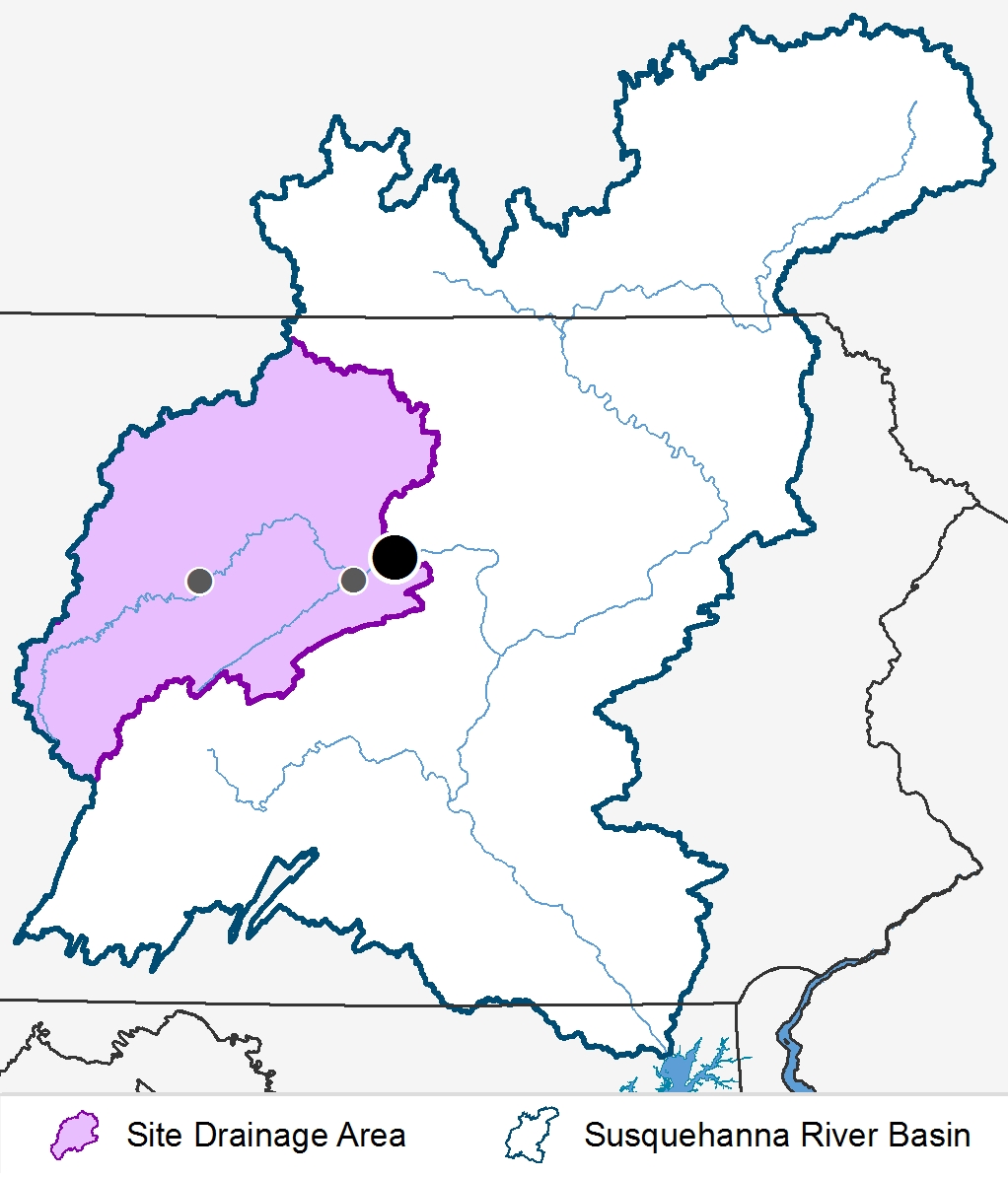
Site Drainage Area

Please select a parameter from the list to view graphs of loads and concentrations. You may need to scroll down to view graphs.
Loads
Concentrations
Data
2023 Flow Normalized Trends
| Trend period (Water Year*) | 2005-2023 |
|---|---|
| Trend & Direction | NS – Not significant, UP – Increasing trend, DOWN – Decreasing trend |
| Hypothesis Test significance level (i.e. α) | 0.1 |
| * Water Year runs from October 1st to September 30th of the following year | |
| Likelihood Descriptor | Range of values** |
|---|---|
| HL (Highly Likely) | ≥0.95 and ≤1.00 |
| VL (Very Likely) | ≥0.90 and <0.95 |
| L (Likely) | ≥0.66 and <0.90 |
| ALAN (About as Likely as Not) | >0.33 and <0.66 |
| ** Values represent the posterior mean estimate of the probability of a trend | |
| Jersey Shore 2005-2023 | Flow Normalized Concentration (mg/L) | Flow Normalized Load (Millions Kg/yr) | ||||||
|---|---|---|---|---|---|---|---|---|
| Likelihood Test | Likelihood Test | |||||||
| Parameter | Change | Value | Descriptor | Trend | Change | Value | Descriptor | Trend |
| Total Nitrogen | 0.0095061 | 0.6372549 | ALAN | NS | 0.6615916 | 0.9705882 | HL | UP |
| Nitrate-Nitrite | -0.0239230 | 0.7549020 | L | DWN | 0.3343759 | 0.8921569 | L | UP |
| Ammonia | -0.0168961 | 0.9901961 | HL | DWN | -0.1285395 | 0.9901961 | HL | DWN |
| Dissolved Nitrogen | -0.0228206 | 0.5980392 | ALAN | NS | 0.2720477 | 0.8137255 | L | UP |
| Nitrate-Nitrite | -0.0148394 | 0.6176471 | ALAN | NS | 0.3664311 | 0.8921569 | L | UP |
| Ammonia | -0.0165650 | 0.9901961 | HL | DWN | -0.1315561 | 0.9901961 | HL | DWN |
| Total Phosphorus | -0.0234212 | 0.9901961 | HL | DWN | -0.1329849 | 0.9705882 | HL | DWN |
| Particulate Phosphorus | -0.0009869 | 0.7156863 | L | DWN | 0.0120452 | 0.5392157 | ALAN | NS |
| Dissolved Phosphorus | -0.0236793 | 0.9901961 | HL | DWN | -0.1424212 | 0.9901961 | HL | DWN |
| Orthophosphate | -0.0189573 | 0.9901961 | HL | DWN | -0.1040921 | 0.9901961 | HL | DWN |
| Total Organic Carbon | -0.0338378 | 0.5392157 | ALAN | NS | -0.3095029 | 0.5196078 | ALAN | NS |
| Total Suspended Solids | -0.2869547 | 0.5588235 | ALAN | NS | 23.8419651 | 0.6764706 | L | UP |
| Suspended Sediment | 3.4065549 | 0.8137255 | L | UP | 76.3774175 | 0.8921569 | L | UP |