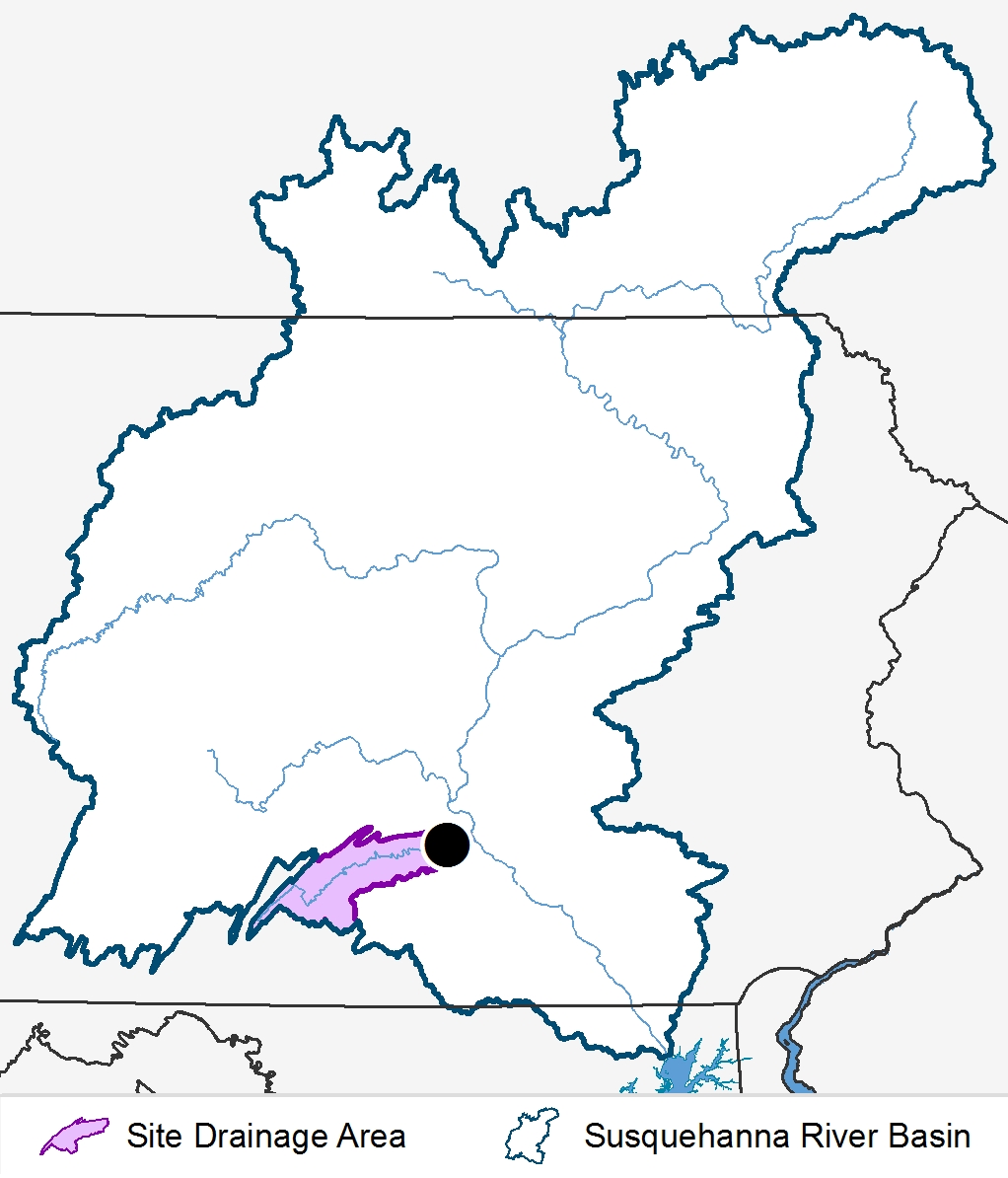
Conodoguinet near Hogestown, PA
Overview
- Station Id: 01570000
- County: Cumberland
- Drainage Area: 467 sq.mi.
- Station Coordinates: 40.255°, -77.019°
- Period of record: 10/04 to present
Location Description
Station is on the bridge 0.74 miles east of Hogestown and 0.68 miles north on Sample Bridge Road.
Data
- Data File Description
- CND.xlsx October 2004 to present
2021 Land Use
| Urban | Agricultural | Agricultural | Forested | Other | ||
|---|---|---|---|---|---|---|
| Row Crops | Pasture/Hay | Total | ||||
| 16% | 26% | 22% | 48% | 34% | 2% | |
Site Drainage Area
Please select a parameter from the list to view graphs of loads and concentrations. You may need to scroll down to view graphs.
Loads
Concentrations
Data
2024 Flow Normalized Trends
| Trend period (Water Year*) | 2005-2024 |
|---|---|
| Trend & Direction | NS – Not significant, UP – Increasing trend, DOWN – Decreasing trend |
| Hypothesis Test significance level (i.e. α) | 0.1 |
| * Water Year runs from October 1st to September 30th of the following year | |
| Likelihood Descriptor | Range of values** |
|---|---|
| HL (Highly Likely) | ≥0.95 and ≤1.00 |
| VL (Very Likely) | ≥0.90 and <0.95 |
| L (Likely) | ≥0.66 and <0.90 |
| ALAN (About as Likely as Not) | >0.33 and <0.66 |
| ** Values represent the posterior mean estimate of the probability of a trend | |
| Hogestown 2005-2024 | Flow Normalized Concentration (mg/L) | Flow Normalized Load (Millions Kg/yr) | ||||||
|---|---|---|---|---|---|---|---|---|
| Likelihood Test | Likelihood Test | |||||||
| Parameter | Change | Value | Descriptor | Trend | Change | Value | Descriptor | Trend |
| Total Nitrogen | -0.518541027 | 0.990196078 | HL | DWN | -0.273352337 | 0.990196078 | HL | DWN |
| Nitrate-Nitrite | -0.584652354 | 0.990196078 | HL | DWN | -0.269252144 | 0.970588235 | HL | DWN |
| Ammonia | -0.009429434 | 0.950980392 | HL | DWN | -0.009873257 | 0.990196078 | HL | DWN |
| Dissolved Nitrogen | 0.498000000 | 0.971000000 | HL | DWN | -0.279900000 | NA | NA | NA |
| Nitrate-Nitrite | -0.291447288 | 0.735294118 | L | DWN | -0.198679710 | 0.950980392 | HL | DWN |
| Ammonia | -0.009567871 | 0.931372549 | VL | DWN | -0.009443726 | 0.970588235 | HL | DWN |
| Total Phosphorus | 0.004494197 | 0.833333333 | L | UP | -0.000523472 | 0.519607843 | ALAN | NS |
| Particulate Phosphorus | 0.003251586 | 0.833333333 | L | UP | 0.001513664 | 0.539215686 | ALAN | NS |
| Dissolved Phosphorus | 0.000552789 | 0.696078431 | L | UP | -0.001197658 | 0.715686275 | L | DWN |
| Orthophosphate | -0.003811282 | 0.990196078 | HL | DWN | -0.004061017 | 0.990196078 | HL | DWN |
| Total Organic Carbon | 0.045155407 | 0.558823529 | ALAN | NS | -0.135164063 | 0.696078431 | L | DWN |
| Total Suspended Solids | 2.562610195 | 0.833333333 | L | UP | -0.224782170 | 0.598039216 | ALAN | NS |
| Suspended Sediment | 13.520393590 | 0.990196078 | HL | UP | 3.323345009 | 0.578431373 | ALAN | NS |