Subbasins
Upper Susquehanna Subbasin
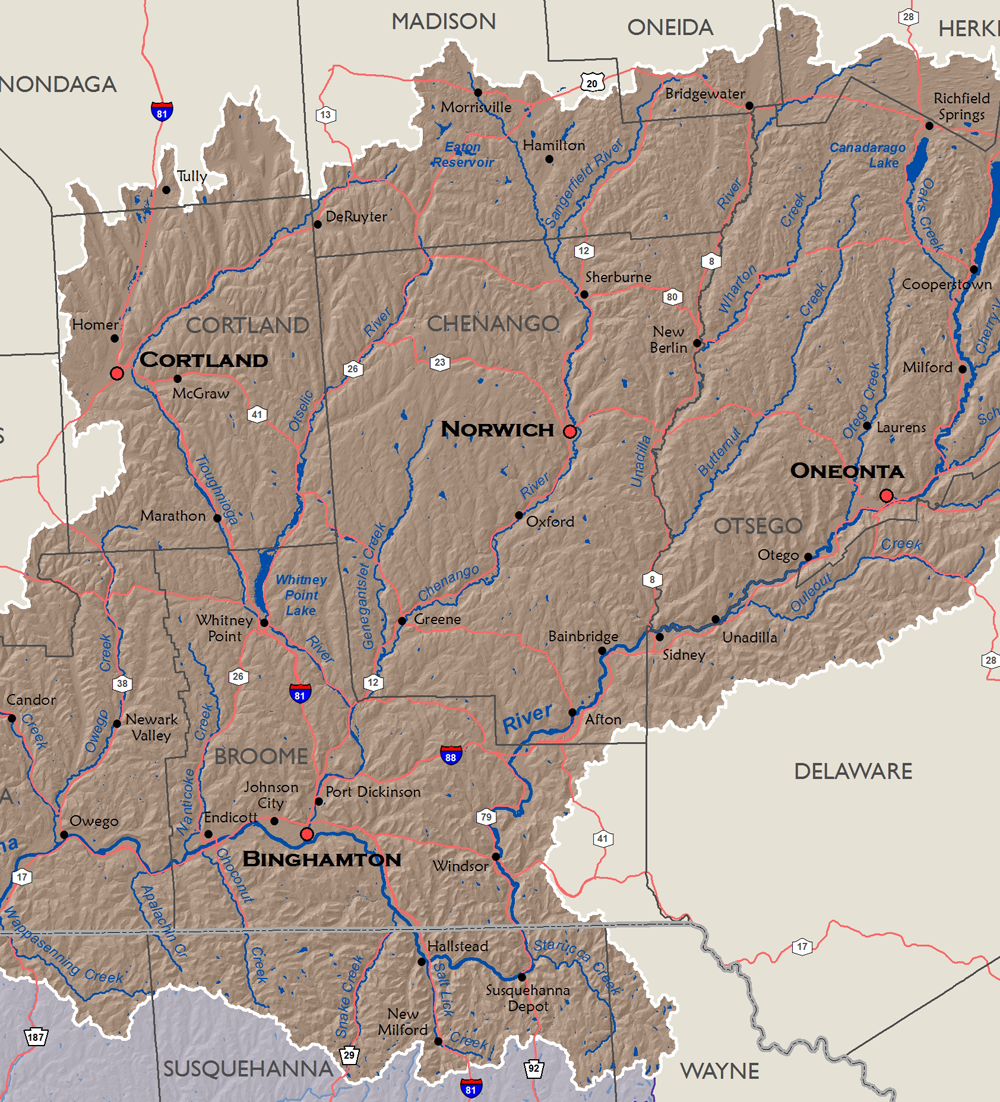
The source of the Susquehanna River is Otsego Lake in Cooperstown, New York. From Cooperstown, the river flows southward through New York and into Pennsylvania just south of Windsor, New York. Downstream of Great Bend, it flows back into New York and continues westward before being joined by the Chemung River at Sayre, Pennsylvania.
Drainage area (square miles)- Total - 4,944
- In NY - 4,520
- In PA - 424
Stream miles: 9,475 (NHD High Res.)
Major tributaries: Chenango River, Tioughnioga River, Unadilla River
Population (2020 Census)- Total - 471,310 (11% of basin pop.)
- In NY - 445,650
- In PA - 25,660
Major population centers: Binghamton, Cooperstown, Cortland, Oneonta, Norwich
| Download GIS Dataset | PASDA - Upper Susquehanna Subbasin Boundary |
|---|---|
| Metadata | Upper Susquehanna Subbasin Boundary, 2006 |
Chemung Subbasin
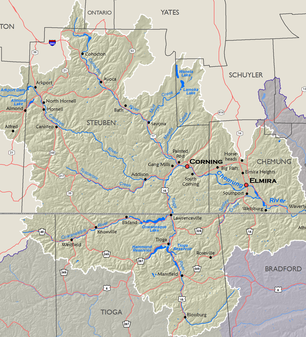
The Chemung River is formed by the confluence of the Tioga River, flowing northward from Pennsylvania, and the Cohocton River, flowing southeast in New York. The Chemung joins the Susquehanna River at Sayre, Pennsylvania.
Drainage area (square miles)- Total - 2,595
- In NY - 1,742
- In PA - 853
Stream miles: 4,241 (NHD High Res.)
Major tributaries: Tioga River, Cohocton River, Cowanesque River, Canisteo River
Population (2020 Census)- Total - 212,850 (5% of basin pop.)
- In NY - 170,990
- In PA - 41,860
Major population centers: Elmira, Corning, Hornell, Mansfield
| Download GIS Dataset | PASDA - Chemung Subbasin Boundary |
|---|---|
| Metadata | Chemung Subbasin Boundary, 2006 |
Middle Susquehanna Subbasin
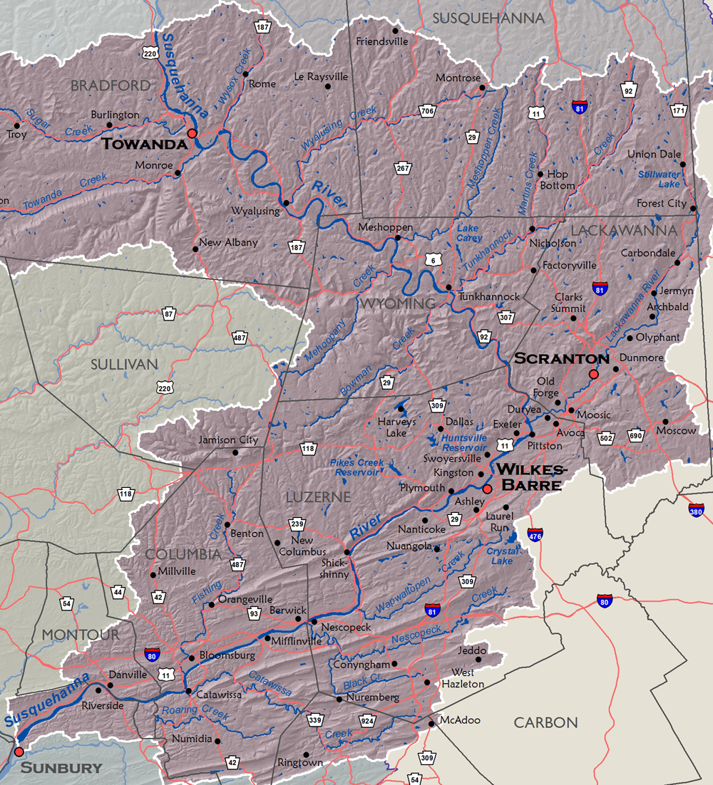
The Middle Susquehanna Subbasin captures the drainage area of the Susquehanna River beginning at the confluence with the Chemung River and flowing southeast. Midway, the Susquehanna River joins the Lackawanna River before turning and flowing southwest towards Sunbury, Pennsylvania.
Drainage area (square miles)- 3,771 (All in PA)
Stream miles: 6,288 (NHD High Res.)
Major tributaries: Lackawanna River, Tunkhannock Creek, Wyalusing Creek, Towanda Creek, Nescopeck Creek
Population (2020 Census)- 696,570 (17% of basin pop.)
Major population centers: Scranton, Wilkes-Barre, Towanda, Sunbury
| Download GIS Dataset | PASDA - Middle Susquehanna Subbasin Boundary |
|---|---|
| Metadata | Middle Susquehanna Subbasin Boundary, 2006 |
West Branch Susquehanna Subbasin
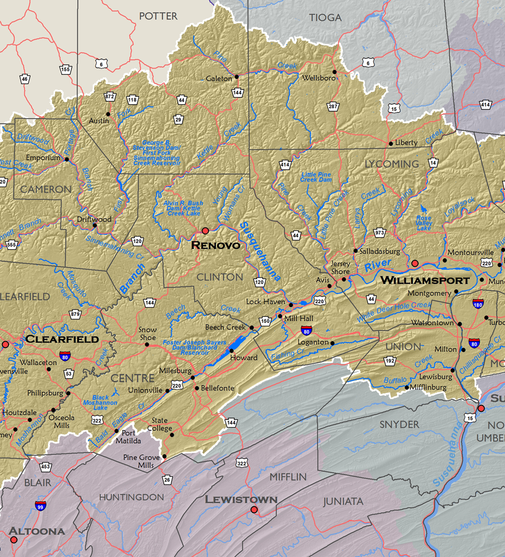
Originating in the low rolling hills of the Allegheny Mountains in Pennsylvania, the West Branch flows northeast towards Clearfield and then Renovo. At Renovo, the West Branch turns southeast until the confluence of Bald Eagle Creek, where it turns east towards Williamsport. Just downstream of Williamsport, the West Branch turns south to its confluence with the Susquehanna River near Sunbury.
Drainage area (square miles)- 6,978 (All in PA)
Stream miles: 12,442 (NHD High Res.)
Major tributaries: Loyalsock Creek, Sinnemahoning Creek, Clearfield Creek, Bald Eagle Creek, Pine Creek
Population (2020 Census)- 481,980 (12% of basin pop.)
Major population centers: Williamsport, Clearfield, State College, Renovo, Lock Haven, Lewisburg
| Download GIS Dataset | PASDA - West Branch Susquehanna Subbasin Boundary |
|---|---|
| Metadata | West Branch Susquehanna Subbasin Boundary, 2006 |
Juniata Subbasin
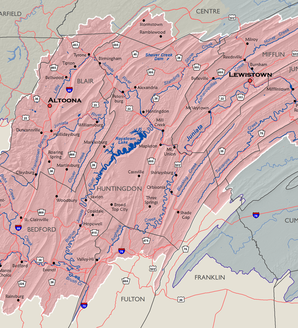
The Juniata River, the second largest tributary to the Susquehanna River, is formed by the confluence of the Little Juniata River and the Frankstown Branch Juniata River. It begins by flowing southeast towards the confluence of the Raystown Branch Juniata River and then on towards Mount Union. There it turns northeast to Lewistown where it once again turns southeast to eventually meet the Susquehanna River at Duncannon.
Drainage area (square miles)- 3,404 (All in PA)
Stream miles: 6,741 (NHD High Res.)
Major tributaries: Raystown Branch, Frankstown Branch, Little Juniata River, Aughwick Creek
Population (2020 Census)- 304,750 (7% of basin pop.)
Major population centers: Altoona, Bedford, Lewistown, Huntingdon, Mount Union
| Download GIS Dataset | PASDA - Juniata Subbasin Boundary |
|---|---|
| Metadata | Juniata Subbasin Boundary, 2006 |
Lower Susquehanna Subbasin
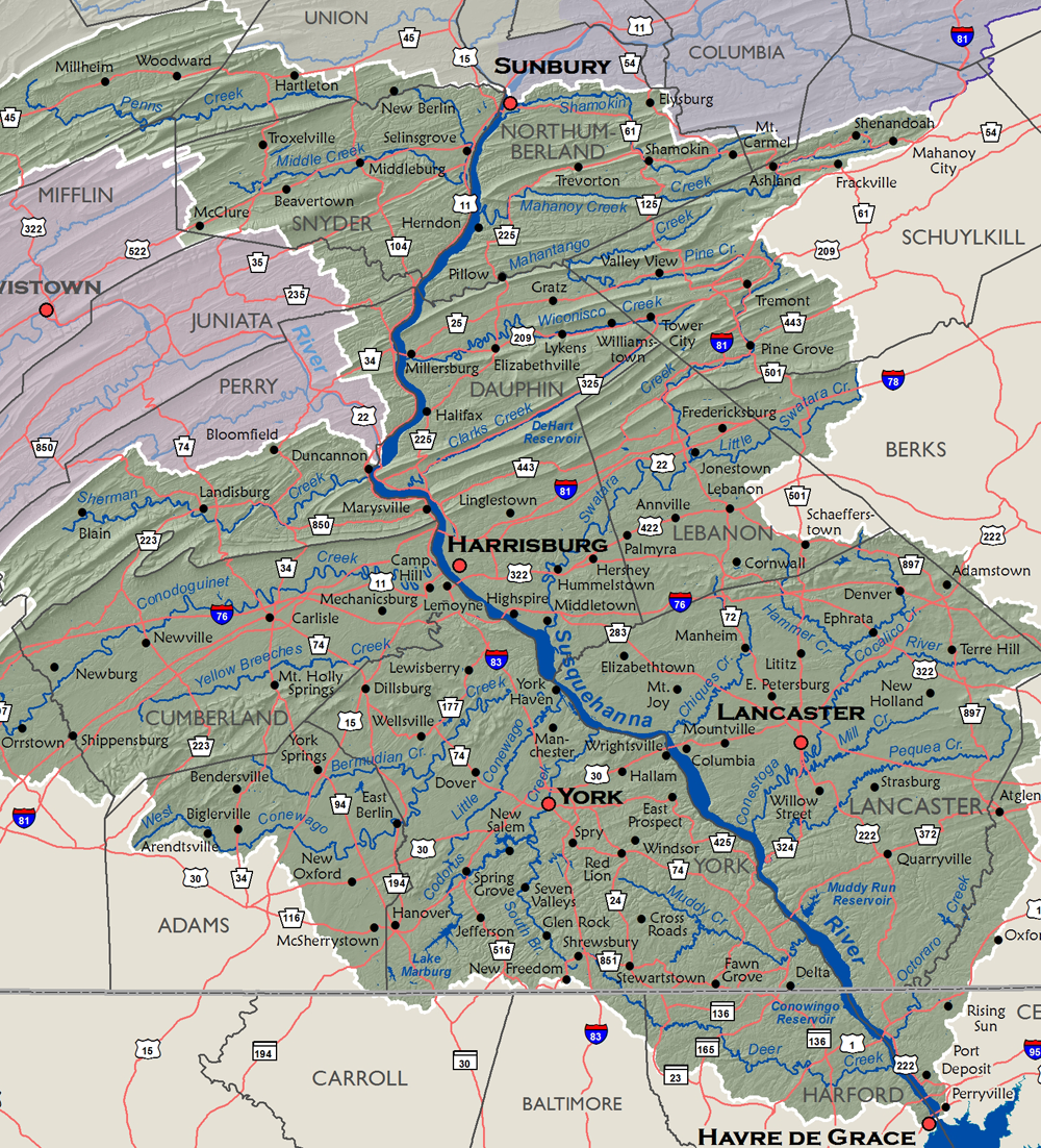
The Lower Susquehanna Subbasin captures the drainage area of the Susquehanna River beginning at the confluence with the West Branch Susquehanna River and flowing south. Midway, the Susquehanna River joins the Juniata River before reaching Harrisburg. There it turns southeast and ultimately flows into the Chesapeake Bay at Havre de Grace, Maryland.
Drainage area (square miles)- Total - 5,809
- In MD - 280
- In PA - 5,529
Stream miles: 10,138 (NHD High Res.)
Major tributaries: Conestoga River, Swatara Creek, Conodoguinet Creek, West Conewago Creek, Penns Creek
Population (2020 Census)- Total - 2,035,000 (48% of basin pop.)
- In MD - 60,150
- In PA - 1,974,850
Major population centers: Harrisburg, Lancaster, York, Havre de Grace, Lebanon, Carlisle
| Download GIS Dataset | PASDA - Lower Susquehanna Subbasin Boundary |
|---|---|
| Metadata | Lower Susquehanna Subbasin Boundary, 2006 |
