10-Digit Hydrologic Unit Code (HUC) Watersheds
The Watershed Boundary Dataset (WBD) is a seamless, national hydrologic unit dataset (USGS WBD homepage). Hydrologic units are standardized watershed or drainage area delineations at varying scales, denoted by the number of digits in the hydrologic unit code (HUC). A 2-digit HUC is very large and represents an entire region of the United States. As HUCs increase in digits, hydrologic units get progressively smaller in area as nested watersheds within a region are delineated.
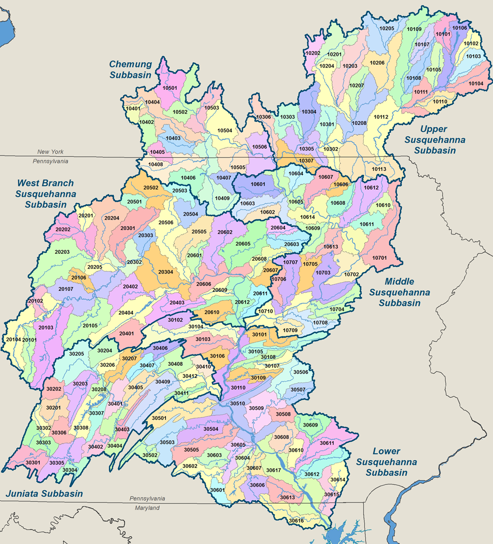
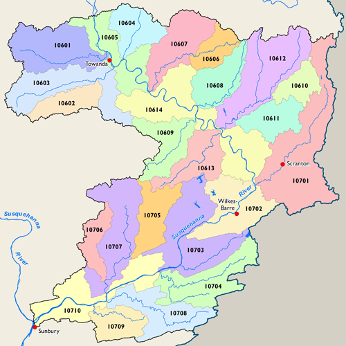
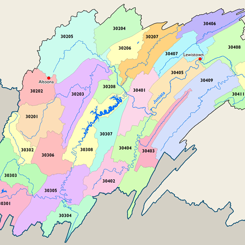
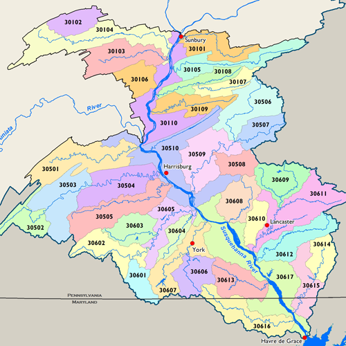
The map at left depicts the 10-digit hydrologic units for the Susquehanna River Basin. The 10-digit scale includes watersheds for 170 of the larger rivers and streams throughout the Basin. The Commission assigns a HUC to all water quality monitoring stations and water use projects which allows for cumulative spatial analyses and for searches on various web portals, such as the Water Application and Approval Viewer (WAAV) and the Water Quality Index (WQI). HUC 12-digit maps, which depict over 800 watersheds within the Basin, are available upon request.
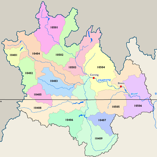
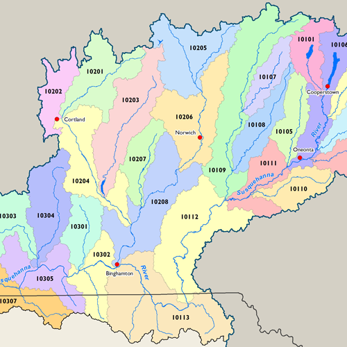
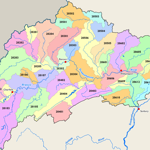
Subbasin Maps
Metadata
| GIS Dataset Title | 10-Digit Hydrologic Unit Code (HUC) Watersheds, Susquehanna River Basin |
|---|---|
| Dataset Description | This dataset is a complete digital hydrologic unit boundary layer to the Subwatershed (10-digit) for the Susquehanna River Basin. This data set consists of geo-referenced digital data and associated attributes created in accordance with the "FGDC Proposal, Version 1.0 - Federal Standards For Delineation of Hydrologic Unit Boundaries 10/2004" (http://www.ftw.nrcs.usda.gov/huc_data.html). Polygons are attributed with hydrologic unit code, name, size, downstream hydrologic unit, type of watershed, non-contributing areas and flow modification. |
| Date | 2008 |
| Scale | 1:24,000 |
| Agency | U.S. Department of Agriculture, Natural Resources Conservaton Service |
| Download GIS Dataset | USDA GeoSpatial Data Gateway |
| Metadata | Watershed Boundary Dataset (WBD) Metadata |
