Flooding
The Susquehanna Basin is one of the nation's most flood-prone areas and is vulnerable to a variety of flood risk including riverine flooding, flash flooding, and ice jam flooding. The Basin's topography, geology and nearly 49,000 miles of waterways are contributing factors to this flood risk. Additionally, the physical location of the Basin in the mid-Atlantic region of the United States subjects the watershed to a wide variety of climatic conditions, including tropical systems, strong thunderstorms associated with plunging cold fronts, and lake effect snowfall. While no one can prevent floods, understanding the flood risk associated with your particular location and appropriate response to National Weather Service issued watches and warnings can greatly reduce the risk to life and property.
New! Please visit a new story maps collection for the 50th Anniversary of Hurricane Agnes!
- Event Summary
- Flood Preparedness
- Mitigation Efforts
- Service Improvements
Current Conditions
National Weather Service Forecast Offices
- Middle Atlantic River Forecast Center
- Binghamton, NY Weather Forecast Office
- State College, PA Weather Forecast Office
- Philadelphia/Mt Holly Weather Forecast Office
- Baltimore/Washington DC Weather Forecast Office
Streamflow Information
- Reservoir Information (U.S. Army Corps of Engineers)
- New York Real-Time Streamflow Data (USGS)
- Pennsylvania Real-Time Streamflow Data (USGS)
- Pennsylvania Current Streamflow Graphs (USGS PA)
- Maryland Real-Time Streamflow Data (USGS)
Types of Flooding
- Riverine Floods - Occur when creeks, streams, and rivers overflow their banks due to significant rainfall or snowmelt in a particular watershed. A Flood Watch is issued when forecast conditions suggest the potential for out of bank flow and a Flood Warning is issued when the same conditions are imminent or occuring at a particular location of interest. Downstream areas may flood well after the rainfall has ended or in areas where no rain occurred.
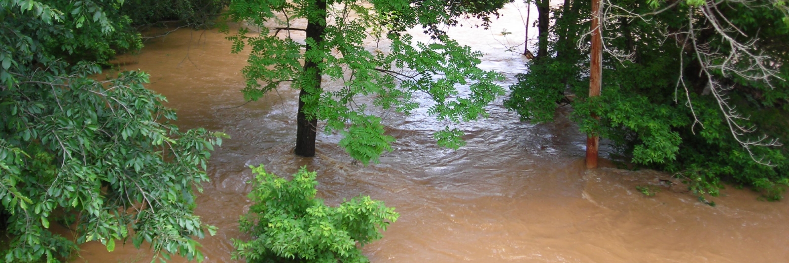
- Flash Floods - Occurs as a sudden transformation of a small stream into a violent waterway due to heavy rain and/or rapid snowmelt. Flash floods can tear out trees, destroy buildings and bridges, scour out new channels, and wash away cars. Life-threatening conditions can develop rapidly with little or no warning. Nearly half of all flash-flood fatalities are auto related. Flash floods can develop within minutes or hours. You may not always receive a warning of these sudden and deadly floods.
- Urban Flooding - Urban flooding results when drainage systems in developed areas are inadequate to safely convey runoff. Localized flooding may result from blockage of storm drains or other drainage structures by debris.
- Ice Jam Floods - Ice can interrupt the normal flow of water when temperatures are cold enough for ice to form shore to shore in riverine systems. Ice jams may result from ice break-up and movement causing flooding upstream from a jam. A sudden release of water from ice jam break–up may cause flash flooding downstream. Ice jams are unpredictable and require constant monitoring for potential hazards.
- 100-Year Flood - The 100-year flood is one that has a 1 percent, or one out of 100, chance of being equaled or exceeded in any given year. The term gives an estimate of the probability that a flood of a certain size will occur, not when it will occur.
Reports
Flood Inundation Maps
Inundation maps provide an expected area and depth of flooding associated with a specific stage at a locally relevant river forecast point (stream gage). The maps allow community residents to identify flood risk related to their own property location. Community officials and emergency managers can use the maps to understand severity of flooding associated with any particular mapped stage and plan evacuation routes and shelter needs.
How to Read a Flood Stage Forecast Map
- Locate an inundation map that provides expected area/depth of flooding relative to your local river gage
- Locate your property on the map.
- Determine the flood stage which will affect you. Consider not only water on your property, but also water preventing your evacuation.
- Listen for forecasts on the radio and television of stages at the stream gage used on the map.
- If the forecasted stage could affect you, begin emergency actions. If not, listen for revised forecasts until waters recede.
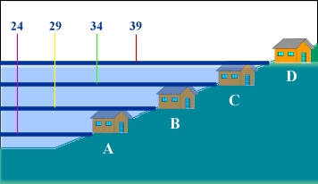
EXAMPLE: If you live in House A, river stages greater than 24 feet [indicated as 24 on the map] would affect your property directly. If your evacuation route goes through a low-lying area, emergency action may be required at a lower stage than the stage affecting your property.
History of Flooding
 Tunkhannock Creek at Noxen, PA
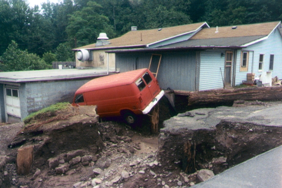
The mainstem of the Susquehanna has flooded 14 times since 1810 – about every 15 years, on average. Even the Native Americans who once lived in the area told of frequent floods. Large-scale and localized flash floods both cause significant property damages and often result in the loss of lives. In June 1972, Hurricane Agnes caused the worst recorded flood in the Susquehanna basin - 72 people were killed throughout the Basin and damages were estimated at $2.8 billion. At the time, the Agnes flood was the nation's most destructive and costly natural disaster.
For comprehensive flood information, forecasts, and maps, visit Susquehanna Flood Forecast & Warning System.